BeltLine NE Trail
Atlanta, GA
The Atlanta BeltLine is the largest ongoing redevelopment project in the United States. The overall project links a series of disused railway belts surrounding the City of Atlanta into twenty-six miles of multi-use trails, transit, parks, art, and economic development.
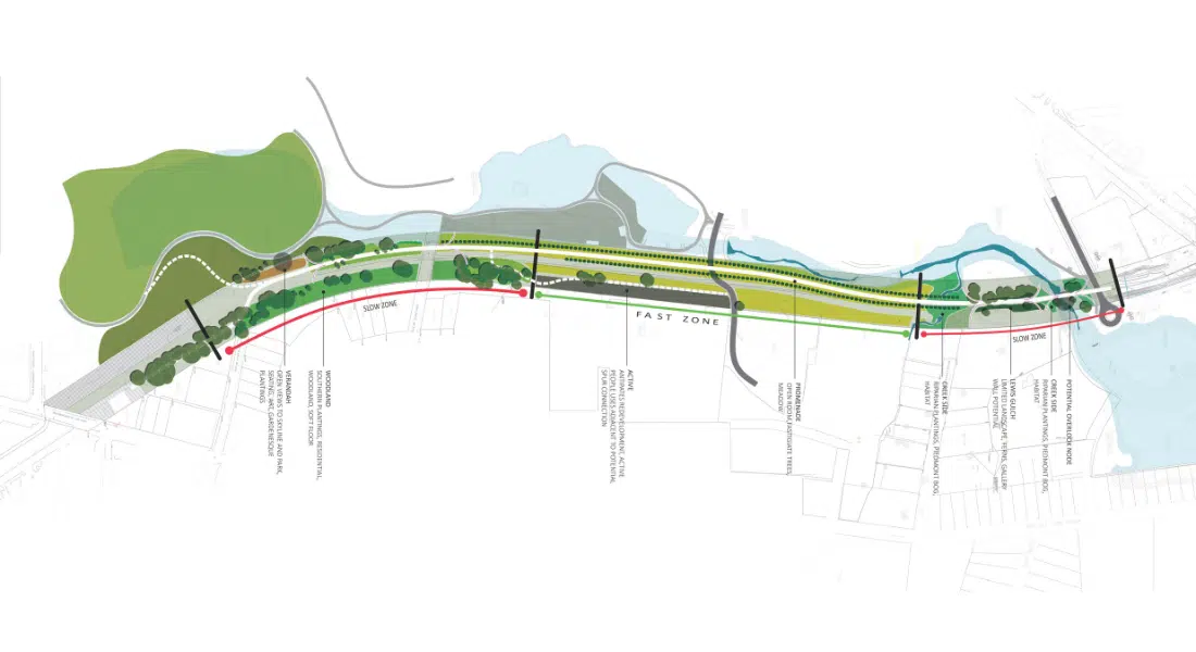
The work for the NE corridor began in 2018 and links the highly popular BeltLine Eastside trail to the Lindbergh MARTA station, and provides connections to major regional attractions like Piedmont Park and the Atlanta Botanical Gardens. The NE corridor will also eventually connect to a broader regional network of multi-use trails including PATH 400 and the Peachtree Creek Greenway.

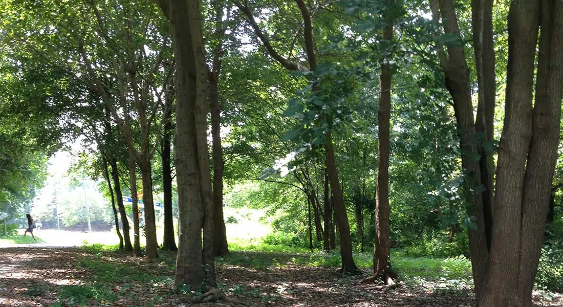
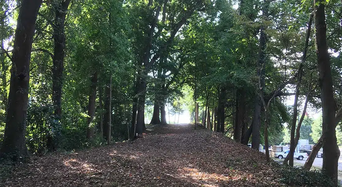
Unlike most of the completed trail network for the BeltLine which exist in former railbeds, the NE corridor transitions from railroad right of way to a series of surface streets and cross creek connections.
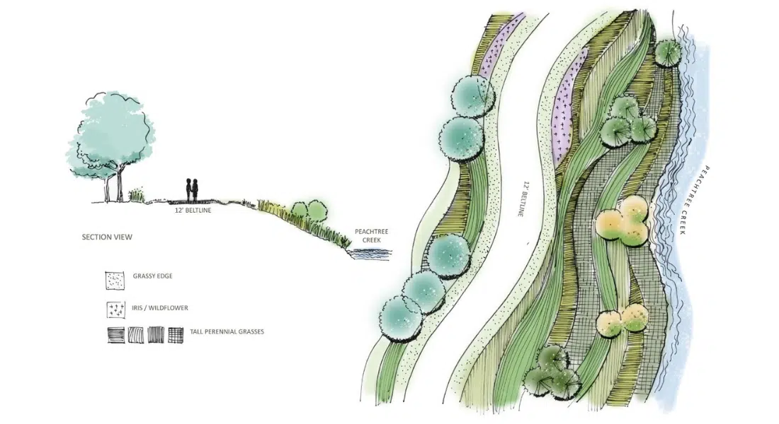
Along the 4.7-mile length of the project, the corridor interfaces with both Clear Creek and Peachtree Creek creating opportunities to uncover these natural, and sometimes unnatural watercourses, exposing their secrets to the citizenry of Atlanta.
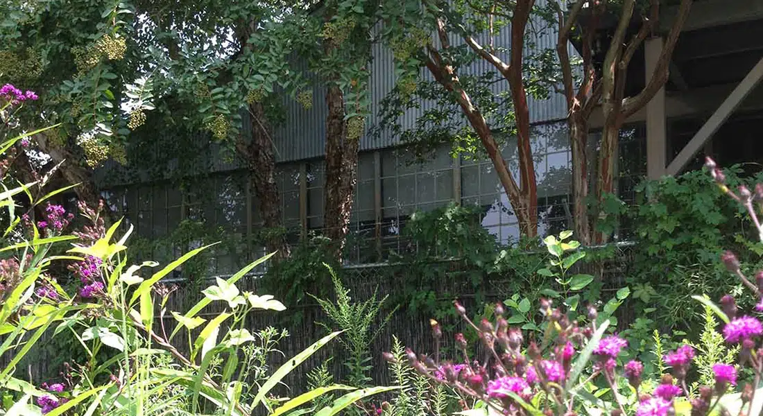
Beyond the constraints of the waterways and roadways, the NE corridor also must weave under, around, and through major infrastructure elements – Interstate 85, MARTA’s north line, and active CSX and Norfolk Southern railroads.
These challenges are seen by the design team as opportunities. Opportunities to highlight some of the history of the corridor and its railroad pedigree. Opportunities for art on bridges, walls, and tunnels. Opportunities to provide extraordinary views of the city as the corridor passes over railroads and conservation easements.
The project is currently planned to be constructed in sections, ultimately providing uninterrupted connectivity between the neighborhoods of northeast Atlanta to regional trail and transit networks.
Client: Health and Lineback Engineers
Owner: Atlanta BeltLine Inc.
Collaborators:
Heath & Lineback Engineers (civil and structural engineering, project management)
Perez Planning + Design (Trail planning and design)
Signature Design (wayfinding)
Edwards Pittman (environmental compliance)
Accura (surveying)
Sycamore consulting (public engagement)
MC2 (geotechnical)
Imagery/Photography:
SITE solutions
The Atlanta BeltLine is the largest ongoing redevelopment project in the United States. The overall project links a series of disused railway belts surrounding the City of Atlanta into twenty-six miles of multi-use trails, transit, parks, art, and economic development.
The work for the NE corridor began in 2018 and links the highly popular BeltLine Eastside trail to the Lindbergh MARTA station, and provides connections to major regional attractions like Piedmont Park and the Atlanta Botanical Gardens. The NE corridor will also eventually connect to a broader regional network of multi-use trails including PATH 400 and the Peachtree Creek Greenway.
Unlike most of the completed trail network for the BeltLine which exist in former railbeds, the NE corridor transitions from railroad right of way to a series of surface streets and cross creek connections.
Along the 4.7-mile length of the project, the corridor interfaces with both Clear Creek and Peachtree Creek creating opportunities to uncover these natural, and sometimes unnatural watercourses, exposing their secrets to the citizenry of Atlanta.
Beyond the constraints of the waterways and roadways, the NE corridor also must weave under, around, and through major infrastructure elements – Interstate 85, MARTA’s north line, and active CSX and Norfolk Southern railroads.
These challenges are seen by the design team as opportunities. Opportunities to highlight some of the history of the corridor and its railroad pedigree. Opportunities for art on bridges, walls, and tunnels. Opportunities to provide extraordinary views of the city as the corridor passes over railroads and conservation easements.
The project is currently planned to be constructed in sections, ultimately providing uninterrupted connectivity between the neighborhoods of northeast Atlanta to regional trail and transit networks.
Client: Health and Lineback Engineers
Owner: Atlanta BeltLine Inc.
Collaborators:
Heath & Lineback Engineers (civil and structural engineering, project management)
Perez Planning + Design (Trail planning and design)
Signature Design (wayfinding)
Edwards Pittman (environmental compliance)
Accura (surveying)
Sycamore consulting (public engagement)
MC2 (geotechnical)
Imagery/Photography:
SITE solutions